The journey this time is a very short one in to Edinburgh. We approach what we believe is the Forth Road Bridge. It seems to have some rather disconcerting gaps in it. Ah! Fortunately this is not the Forth Road Bridge, or at least not yet; it is still under construction. I am disappointed that no one is actually in the process of painting the real Forth Road Bridge. There are warnings of a running event in the city but we are aiming for the north of Edinburgh so hope to avoid this. We later discover that this event is not until tomorrow and that it is the Edinburgh marathon. I am quite excited to be directed down Quality Street; this does actually appear to be the Quality Street. It might have been better if we had not been directed down Quality Street as we are in the midst of another sat-nav fail. This time it knows where site is (unlike the last two destinations) but seems to think that our caravan will fit down a road blocked by bollards with the gap between them barely wide enough for a car, sigh.
Today is the first time since we reached Scotland that we have been able to go out in tee-shirts, well Chris is in a tee-shirt; I still have a jumper on. We are trying to find the Chapel of Rosslyn, which has associations with the Knights Templar, always a fascination for me. Wouldn’t you think it would be in a place called Rosslyn? Nope. It is in Roslin, which is not what I was putting in the sat-nav! When we find it, along with four coach loads of other tourists, there are guide leaflets in every language but English. The rationale behind this is that the interpretation boards are in English, so we won’t need a leaflet. I would like to take one home so I opt for French on the grounds that I may understand one word in three. First comes the Old Rosslyn Inn, which was opened from 1660-1866 but is now a private house. It was patronised by ‘celebrities’ such as the future Edward VII, Walter Scott, William and Dorothy Wordsworth and Robert Burns.
The Chapel was begun in 1446 by Sir William St Clair, Prince of Orkney, who owned nearby Rosslyn Castle. What was known as the Collegiate Chapel of St Matthew, was intended as a private chapel so masses could be said for the souls of the St Clair family. The chapel was built in an over the top gothic style using local stone and probably employing French masons. It took forty years to ‘complete’ but was half the size of that which was originally planned, perhaps because the impetus was lost with the death of St. Clair.
One advantage of all the tour buses is that we can eavesdrop on a group’s commentary. A French guide explains, in very good English, some of the symbolism behind the many carvings. She is aided by a green laser pointer. Our attention is drawn to over 100 green man carvings. This pagan symbol is not unknown in chapels but so many of them is very unusual. There are, understandably, carvings that are full of religious symbolism as well as animals and plants. The plants include maize, which is strange as it was carved fifty years before Columbus discovered America. There are angels playing instruments, including bagpipes, a dance of death and depictions of the seven deadly sins. There is a legend attached to two of the carved pillars. One was supposed to be executed by the master mason and a more elaborate one by the apprentice, who was inspired by a dream. The incensed mason then killed the apprentice in a fit of jealous rage. Two of the gargoyles are supposed to depict the mason and his apprentice, complete with head wound. Ironically, the mason is sited so that he stares at the apprentice’s column.
The chapel is associated with the Knights Templar, early twelfth century warrior monks whose role was to protect pilgrims on crusade and to find and guard treasures from the Temple of Solomon in Jerusalem. The chapel came to prominence because it features in Dan Brown’s Da Vinci Code and the visitor footfall increased five fold as a result. After the Reformation, prayers for the dead were no longer customary but the chapel is still in use for regular services. Monck stabled the horses of the Parliamentarian forces in the chapel in 1650. By the eighteenth century it had fallen into disrepair and as a ‘ruin’, become a focus for Romantic poets and artists including Turner. Its initial restoration was inspired by Queen Victoria and now there are 175,000 visitors a year, many of whom seemed to be there on the same day as us. I was a bit disappointed that there was not more information on the Knights Templar but it was fascinating nonetheless.
 On the way back to the van we call in at Currie, where my granddaughter’s ancestors came from but no luck with the graveyard here. There are some very unusual stones there though.
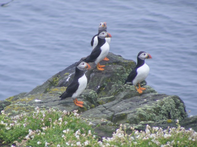 We start to see more and more seabirds through the mist and drizzle, including my first ever puffin! As we near the island the water is thick with guillimots, razorbills and more puffins. We have three hours to spend on the island and we walk most of the pathways. Departing from the marked routes is strictly forbidden in case puffin burrows are damaged. Even with my very basic £100 camera I manage half decent, recognisable shots of the islands birds. Apart from the puffins, razorbills and guillimots there are, oystercatchers, shags, fulmars, black-backed gulls (lesser and greater), fulmars and kittiwakes. There is also an active tern colony and the terns dive bomb the visitors making their strange ticking cries (that would be the terns’ cries, not the visitors). Eider duck nest right by the pathways; I had forgotten that the females were a drab brown, in contrast to their gaudy husbands. A tremendous plus for having had to do this part of the trip two years later than originally planned is that, had we made it here as intended in August 2014, there would have been far less to see. Despite the chilling wind I am having a great time, though I agree that slightly warmer weather would have been the icing on this particular cake.
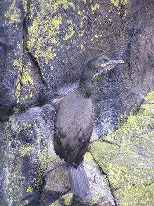 A great deal of what is known about sea birds and migrations patterns is thanks to data collected on May. Only the researchers live on the island as the lighthouse is now automated. It is 200 years old and was built to replace the oldest lighthouse in Britain, which was a coal fired beacon tower dating from 1636. This took between one and three tons of coal a night to maintain, all of which was brought from the mainland and hauled to the top of the tower. The island used to be a monastic foundation, with St Ethernan’s shrine attracting pilgrims since the seventh century. The island was home to St Adrian until he carelessly got murdered by the Vikings in 875. In 1500, James IV had a picnic on the island, because he could I guess. After the 1715 Jacobite rebellion, three hundred fleeing Jacobites somehow got stranded on May for eight days without food.
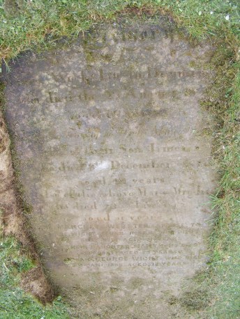 After about five minutes casting our eyes round stones with all the wrong names on and on the point of giving up. I locate Mr Sharp who should be next door to the Wight family. Yes, there is a flat stone nearby but compacted grass, the product of many mowings, is stuck firmly to its surface. I wish, too late, that I had taken a ‘before’ photograph. We begin rubbing away, being careful not to obliterate the sandstone surface at the same time. Grass has grown quite a long way over the edges of the stone, covering the inscription. I decide that we need a spade to remove this. We do not have a spade, how short sighted of us. Chris has his barber surgery kit in the boot ready for a conference at the end of our trip. I suggest using one of his many knives, saws or axes to hack back the grass; he seems less keen. We imperil our finger nails by hauling at the grass roots. As for the mowing detritus, in the end we perfect a technique of rubbing the soles of our shoes over the grass, which eventually loosens and can be swept away. This works better with my trainers as Chris has smooth soled shoes on. Well, that was his theory and he was sticking to it. It is quite a large stone and I am rubbing vigorously. If you are ever tempted to try this, be warned, it involves a lot more effort than you would think. The weather has meant that today is the first day we haven’t been for a walk but I decide that stone clearing constituted sufficient exercise. Ten minutes later and the stone is as clear as it is ever going to be and I am well pleased.
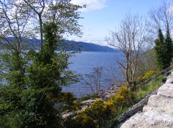 ng that they might see bears at ‘Highland Bear Lodge’. Maybe highland bears are akin to yellow tits and indeed the Loch Ness monster. We drive through pretty birch woods to Glen Affric. There are more sheep in the road; these are sitting down contentedly as if they were in a field. There are deer relaxing nearby, maybe they have evicted the sheep. We pass the Fasnabyle HEP plant, reminding us how important the energy business is to Scotland. We head back towards Inverness by a different route, with the River Glass on the right and a bluebell wood on the left to enter the Black Isle, between the Moray Forth and Cromarty Firth. This peninsula, previously named Ardmeanach, was given to Lord Darnley by Mary Queen of Scots. The views are glorious. I find this one of the most attractive parts of Scotland, yet I was expecting to prefer the west coast.
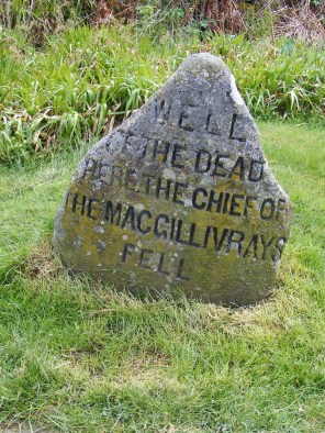 It is interesting to fully appreciate that Cumberland’s government red-coat army of 10,000 men would need 10,000lb meat and 10,000lb bread each day to sustain them. The lack of supplies for the Jacobite forces was a significant feature at Culloden, along with the boggy terrain which led to the failure of their previously successful charging technique. The battle lasted less than an hour and nearly half the 1500 Jacobite casualties fell in the few minutes of this failed charge. The government troops lost only 50 men, although some of the 250 wounded died later. The Irish and French, who were fighting for the Jacobites, shielded Bonnie Prince Charlie’s retreating army, who headed for Inverness after the battle. These Irish and French were subsequently treated as prisoners of war not rebels. The Jacobites did regroup at Ruthven and were prepared to fight on but Bonnie Prince Charlie sent orders to disperse and the cause was lost, leaving Charlie to escape ‘over the sea to Skye’ with the aid of Flora MacDonald.
 Our site at Dunnet Bay is exposed but right by the sea and we have a pitch that has what might be classed as ‘sea glimpses’. After setting up the van we depart for John O’Groats, well you have to don’t you? It isn’t quite as commercialised as Land’s End or Gretna Green and it seemed important to visit what claims to be the most north-easterly settlement in Britain. There are some weird multi-coloured wooden buildings, which are apparently extensions to a hotel. If they were trying to look like Balamorey they’ve failed. A little like Land’s End it isn’t actually the extremity that people would have you believe. Dunnet Head is the most northerly point and we plan to visit there before we leave. We are primarily in John O’Groats to pick up our tickets for tomorrow’s trip to Orkney and to see where we need to be first thing in the morning. That accomplished, we move on to Duncansby Head. We arrive in a fierce hail storm and decide to sit it out, hoping for a gap in the precipitation so we can visit the fulmar colonies that nest on the cliffs here. Yes, Scotland’s weather does it again and within ten minutes it is dry and we decide to risk it. The ground however is anything but dry and is best described as spongy. Chris has his walking boots; mine are in the van so I paddle along in trainers as far as Duncansby Stacks.
 As we have come quite a distance to spend not very long looking at the barracks we decide to stop off at Loch an Eilean on the Rothiemurchus Estate on the way back. The original plan was to walk four miles or so round the loch. By this time it is not only 5.00pm but very cold and drizzling so, despite having made a financial investment for car parking, we just take a very short walk along the loch side to see the castle in the middle of loch. We try and fail to find the monument to Major General Brook Rice who drowned in the loch whilst skating. This is allegedly the number one picnic place in the UK. I debate whether this is a self-styled title. I am sure it would be very lovely if the temperature were fifteen degrees higher. Having satisfied ourselves that we have actually done something today, we head for home. The weather forecast for our booked trip on the funicular railway tomorrow is not encouraging, ah well, this is Scotland and rain it must.
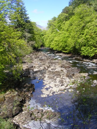 It is a lovely sunny day, contrary to the predictions of weather forecasters, although there is still snow on the nearby peaks. We take a walk a mile or so into Killin and follow some of the heritage trail. Here we are in what is described as ‘The Heart of Breadalbane’, or the high country of ‘Alba’, which was an ancient Scottish kingdom. Killin is a natural place for a settlement as it is at the confluence of the Dochart and the Lochay rivers. Our walk takes us as far as Dochart Falls, which are beautiful.
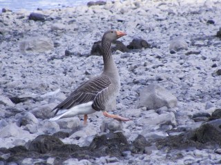 We are out of practice with walking and have done no more than gentle strolls since our accident last year, so we are unsure how we will hold up. We decide to walk for two hours and then turn round. As two hours approach, we enquire of one of the many people heading in a clockwise direction, how far it is all the way round the lake. We are told it is eight miles. It is a little rough in places but flat so we change our plan, as it seems it would only be a little further to complete a circumnavigation and it it always preferable to have a circular route. There are plenty of wildflowers to observe and we see many tadpoles in a large puddle. None of the ramblers’ group coming in the opposite direction seem to have been observant enough to spot these, so we point them out.
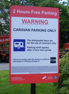 Next day and it is off to a supermarket near us to stock up. Pizza seems like a good idea, just a shame that the one we chose was larger than the fridge. I have a way of solving that but not one that is commensurate with watching what I eat. We run the gauntlet that is the stop start, roadwork-ridden M5 and M6. Then a comfort stop at a services near Preston. There are ten long spaces especially allocated for caravans. They contain three caravans, one of which is us and seven things that are patently not, by any stretch of the imagination, caravans. It isn’t as though there aren’t very large signs explaining the situation and ample empty car spaces very close by. I am tempted to remark, ‘what a strange caravan’ in a loud voice but I just manage to restrain myself. The next caravan owner that arrives and finds nowhere to park will be serious p****d off. We know this is the frozen north and folk are hardy up here but I am not sure that, despite the sun, this is really sitting outside in tee-shirt weather however many people are braving the still chilly wind as if this is summer.
 I have to say the ‘interesting’ access was worth it. This is a truly beautiful, wooded setting, only yards from the footpath round Derwent Water. We have just got set up and the kettle on as Hazel and Martin arrive. Sadly we can’t offer them a drink as we only have two cups. We chat then head off to Mary Mount to eat – not the most inspiring name but great hunter’s chicken and stupendous views of the lake. Weirdly though, when we tried to book, we were told it was full but we could sit in the bar. In the event we sat outside but the restaurant seemed far from full. We finish the evening with a quick walk round part of the lakeside, heading in a clockwise direction.

