As usual, you are not getting these reports in real time but I’ll catch up eventually.
Day 1
Having spent the past days soaking my garden plants with water and moving most of what turned out to be nearly fifty plant pots to the shady part of the garden, I felt relatively ready to go away. Turns out there were to be a few hitches. I arrived at Chris’ to be told that he was waiting for roadside recovery as the caravan-towing car wouldn’t start. Fortunately, this was speedily resolved. By this time, I was starting to remember the things that I had forgotten. The list included a belt and the trousers I was wearing were the sort that descend, taking one’s knickers with them. I was able to borrow a belt from the fisherman of my acquaintance. Even better, it looked like I’d borrowed it before, as it had had a me sized hole added to it.
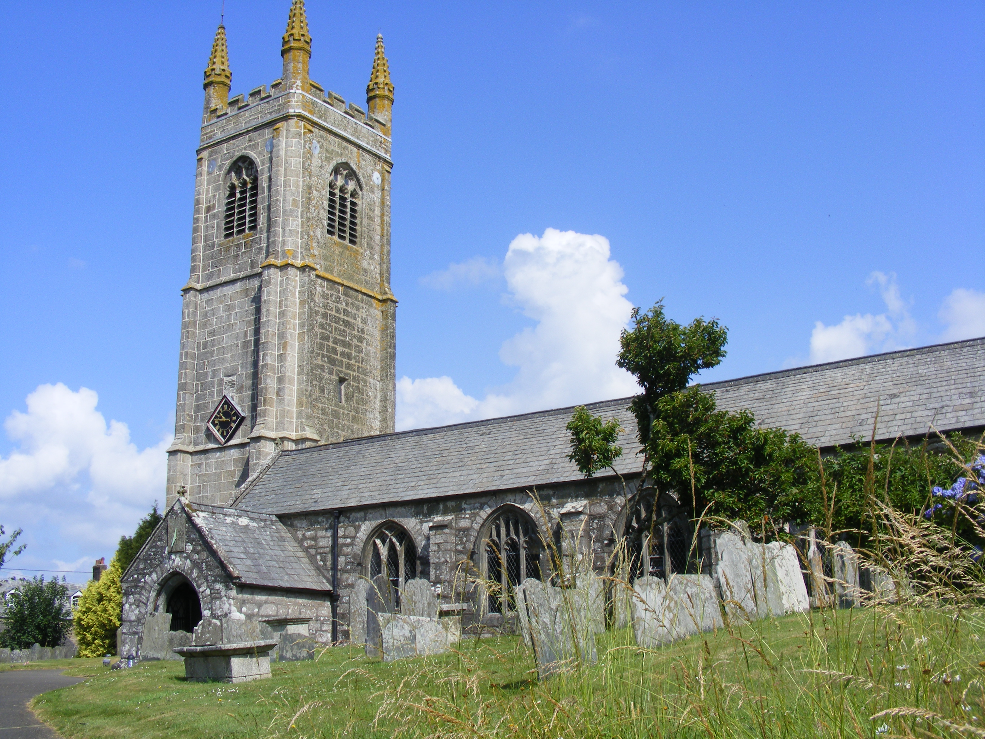
My travelling companion had to stand in for a holidaying churchwarden but I decided to forsake the church with the second most uncomfortable pews in the world and walk down Clovelly High Street instead. I was hoping to get some photos suitable for advertising next year’s Devon Family History Society conference but scaffolding and a dull day put paid to that. I am sure the street is steeper than it used to be; despite not going right down to the harbour, the slog back to the top was a bit of an effort.
We were finally on our way just after midday. I then realised that I hadn’t brought the maps with me. These weren’t needed for finding our way (or so I thought – see below) but I do like to follow along on a map. We arrived at our site not far from Helston, Cornwall. We were the only van on site, with rabbits for company and horses from the neighbouring field and the farm’s resident dog coming to say hello. This was meant to be a restful holiday, so we did just that.
Day 2 Kynance Cove
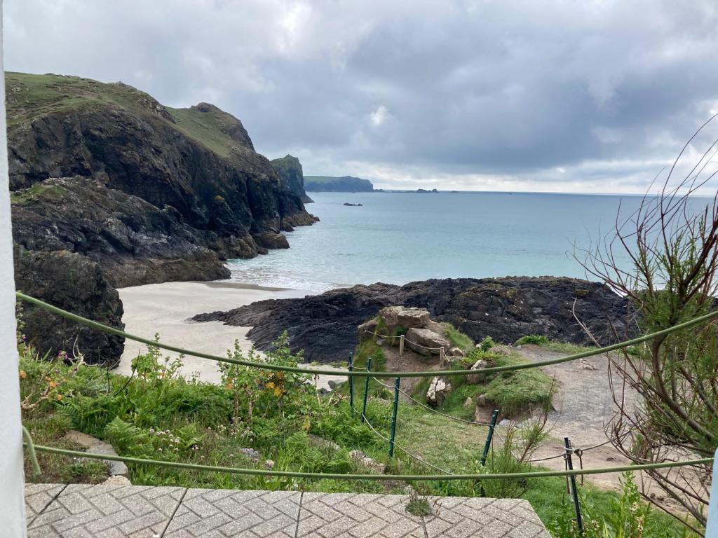
After a short drive, we availed ourselves of the free members’ parking at the National Trust car park and prepared for a short walk along part of the south-west coastal footpath near Kynance Cove. We have previously walked the whole of the Cornish section of this long-distance path but it was soon obvious that we are not as young or fit as we were. If this section of the path isn’t described in the book, which I have also forgotten, as strenuous, then it should be. We scrambled down the cliff side, wandered across the sand at Kynance Cove then struggled back up the other side. One excitement was not only hearing but seeing a cuckoo; I’ve never seen one before. Sadly, I wasn’t swift enough with the camera.
We went a little further on then, being well aware that every step further on also meant an additional step to retrace, we turned round. We treated ourselves to a drink at the café on the way back and I felt that it would be rude to refuse the carrot cake.
Back in the car, we took a short journey to Landewednack to look at the new Lifeboat Station which seems to have some kind of life down to the shore and then for good measure, the old Lifeboat Station at Church Cove. This involved parking under a very noisy rookery and hoping that the car wouldn’t need too much of a clean afterwards. That being enough exercise for one day, we went back to the caravan, where we lazed the rest of the day away.
Day 3 Godolphin
Another short drive, this time to visit the National Trust property, Godolphin. We knew the house itself wouldn’t be open but planned to explore the estate. I cleverly, or so I thought, photographed the map of the various coloured footpaths before we started. I did this on my camera; fail. I should, of course, have photographed it on my phone so that it could be enlarged. We completed most of the not terribly inspiring yellow route through fields and woods, alongside the River Hayle. The plan was to transfer to a short part of the pink route to the house, garden and café. Somehow we ended up on the purple route. Nonetheless, I was pretty sure which way we needed to go. It turned out that I was right. Unfortunately, I decided I should check the map. Finding a landmark on the opposite side of the road to the one I expected, we turned round and walked and walked some more. If only we had a proper map. Never fear we had phones with apps including Google maps and what the family call the spooky stalking app. What we didn’t have was anything resembling a phone signal. We approached a small settlement that boasted a post office, hurrah someone we could ask for directions. Said post office was only open one day a week, inevitably not the day we were there. Finally a passer-by. Better still, one who used to work for the National Trust. She set us on our way, retracing many steps. This also involved scaling walls using a strange for of style, some of which had ‘steps’ that were a very long way apart. She did also admit that the map left much to be desired and it appears that the key landmark was indicated on the wrong side of the road.
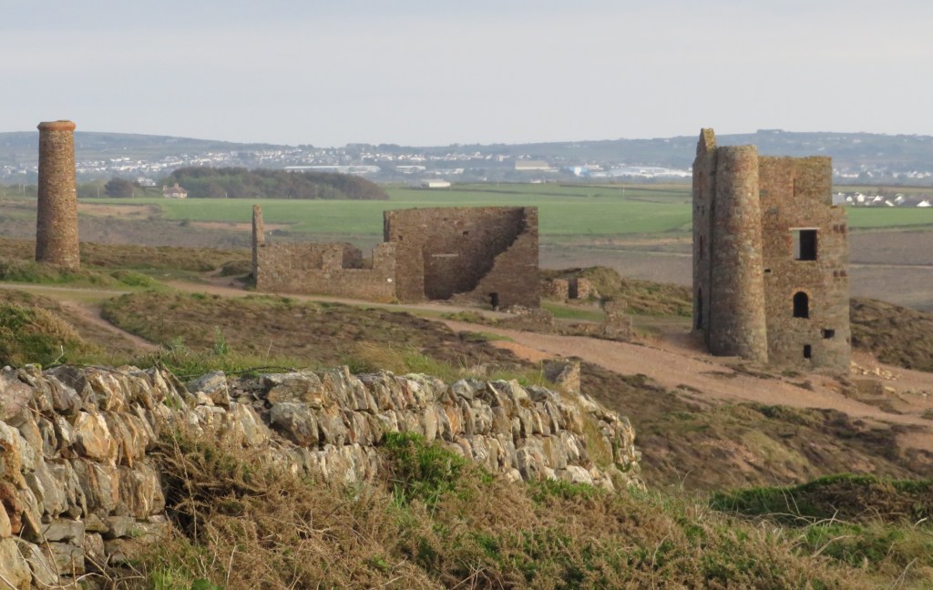
We finally approached the house/café/toilets (in reverse order of importance). We felt that we had earned our orange cake and lemon meringue donut. We looked at the C17th exterior of the house, which apparently has a colonnade that is unique in the country. The house and estate were developed by the prestigious Godolgun (later Godolphin) family, who acquired it in the C12th. They made their fortune from mining copper and tin. The mining landscape in the area is a UNESCO World Heritage site. The farm buildings are particularly superior and were built with stone from a former house. There was an interesting film show about dairying in the dairy.
We looked round the grounds and spotted what looked like a water trough. It had inexplicable notches of different depths, set at irregular intervals round the edge. We speculated what it might be used for. Enter stage left my former colleagues on the experimental archaeology course. Something very similar on the continent is described as a Roman olive mill. Another suggestion is that it was used by a blacksmith and cooling irons could be rested in the notches. The jury is still out; further suggestions welcome – answers on a postcard.


 Our first task at Cothele is to hunt out our memorial tree in the fruit orchard. We think we know roughly where it is. We also think we know what variety it is but we fail to locate it. Once again we are hampered by the environmentally friendly attempt to let the orchard go wild. Tramping through long grass trying to find a variety label that has probably long since gone is not fun. Reception provide us with a guide, which suggests that we are looking for the wrong type of tree. I am still not sure that the tree we pay homage to is actually the one that Martha and I planted in 2008; we are both convinced it was a different variety, to the extent that I purchased one of the same type for my garden.