Discovering Eden

After more than ten years, we decided to make a return visit to The Eden Project. We arrive early and are directed to Lime 1 car park, which is nearer to the entrance than some. We walk down to the entrance and wave our annual passes, which were the same price as a single in advance ticket. Last time I came, I qualified for reduced student status entry. We wander round the pathways surrounding by a stunning variety of plants. The round the world allotments are fascinating, each growing vegetables that feature in a different international cuisine, that is now represented in the British cultural mix.

Next it was time to enter the biomes. This is the nearest I am going to get to the tropical rainforest. Perhaps it is because there is less contrast with today’s outside temperature but it doesn’t seem to be as unpleasantly hot as we remember from our previous visit. I spend some time trying to photograph the roul roul. These are birds that live in the biome in order to control the insects. They all seemed to travel in pairs and some had chicks. The photography was tricky for several reasons. These little, quail-like birds never keep still, continually making a backward scratching motion with their feet, presumably hoping to bring insects to the surface. They also like to shelter under the leaves, making it quite dark and using flash was not appropriate. My cheap camera is really not up to this. We climb the aerial walkways but pass on the very highest look-out. We then move to the Mediterranean biome, a foretaste of our upcoming holiday.

There is a building called The Core, which I think was being constructed last time we were here. This includes some art installations that I am not sure I fully appreciate. Infinity Blue, billed as a breathing sculpture, is however fascinating. Periodically, it huffs out smoke from apertures around it’s twenty-five foot high form. More not hugely successful photographic attempts ensue, as I try to capture the smoke rings.

I climb round a grassy area to photograph some wild flowers. It is only on my way back past a barrier that I spot the sign that reads no admittance – oops. The whole regeneration concept of Eden appeals to me. It is sited in a former quarry, a legacy of the china clay trade. I would like to see a bit more of the history represented but the use of the site as a way of ‘promoting the understanding and responsible management of the vital relationship between plants, people and resources leading to a sustainable future for all’, is admirable. Being a former quarry, the site is decidedly slopey and we have done our fair share of walking up and down hills over the past few days. We decide to head back to the car, especially as there are black clouds looming. We wander up, we wander down. There are helpful signs directing us to various parts of the site. None seem to indicate the way out. Shades of Glendurgan once again; are we trapped here forever? It seems not and evetually we are on our way.

On our outward journey we passed through Luxulyan. I have Cornish ancestors; much of this part of my family history has had little attention for more than forty years but Luxulyan rings a bell. We stop off so I can take a quick photograph just in case. The rain comes to nothing and I take a look at my Cornish ancestry in preparation for a tour round some ancestral parishes in a few days’ time. I may have made a minor breakthrough.

A Riverside Walk

We return to the south coast to revisit one of our favourite stretches of the south-west coast path. I picked up a ‘where to park for free if you are a National Trust member’ card at Bedruthan and this is proving handy. We head for Bosveal, which is pretty much a car park and nothing else. Following the coastal footpath westwards to Durgan takes us to the back entrance of Glendurgan Gardens. Thinking it would rude not to take a look, we enter. Let’s be clear, this is a legitimate entrance and the notice on the gate instructs us to pay, or in our case show our membership cards, at the main entrance. Main entrance? We walked up, we walked down, we declined the option to walk round the maze, which is in any case full of a school party. We seem to be in a maze of our own. We think we can see where we need to go but that pathway is marked private.

The garden is beautiful by the way, nestled in a valley which gives it a near sub-tropical climate. The weather has turned quite humid today, which adds to the atmosphere. In the end we give up the fruitless hunt for the main entrance and continue along the path to Helford Passage with the Helford River estuary on our left. We are decidedly out of walking practice and it really is very hot. Conscious that every step we go forward, means another step to go back, we return to Bosveal, with a short stop for an ice-cream on the way.

043 10 July 2019 Helford River

A quick supermarket visit before driving north once again The good thing about Cornwall is that is a long narrow county, so it is never very far from north to south. Fortunately, our evening meal was cooking before I noticed that a mobile pizza van, whose owner has enhanced grammatical skills in comparison to that of the fish and chip van proprietor, is due to visit the site tonight.

Elizabethan Delights

The weather continues to be hot and sunny, an ideal counterpoint to the Cornish landscape. Today we head to Trerice, another property owned by the National Trust. Again we arrive in time for an introductory talk. This is not on the scale of Richard’s in-depth presentation at Levant Mine, which is probably just as well, as I am standing in full sun. I am smothered in factor 50, unusual for me as my boot-leather skin withstands most that our climate throws at us but this prolonged sunny spell has had even me turning to the bottle.

This area has been farmed since the iron age and there is a record of an Udo Trerice owning a longhouse in 1300. The name means farmstead (Tre) by the ford on the running water (rice). The fact that, until the sixteenth century, the river at the back of Trerice was navigable to the coast and that the river was fordable at this point, explains the decision to build here. Michael Trerice, son of Udo, had a daughter Jane but no sons. She married Ralph Arundell and the estate passed to the Arundell family. Strangely, I have always pronounced this Arun-dull (like the place in Sussex) but our guide is saying A-rundell. Regardless of pronunciation, the Arundells were on the up and became one of the major landowning families in Cornwall. In 1572, John Arundell built the current Trerice in order to have a home that was commensurate with his status. The house is small but bears many of the hallmarks of the archetypal Elizabethan manor. It was created in the traditional, symmetrical E shape, in honour of the queen. One wing of the house is now missing. We find it difficult to make sense of the layout. The ‘front’ is clearly more ornate but somehow, to us, the ‘back’ is more convincing as the original front, if you see what I mean.

The house is built from locally-quarried Elvan stone, which is a warm yellow colour. The regular-sized, hand-hewn blocks were just one of many features that were a testament to the wealth of the owner. There were fashionable Dutch gables, a ‘feature’ glazed window in the hall, chimneys, plasterwork ceilings and a long gallery, so the residents could exercise in bad weather. There is also a knot garden, which is currently filled with lavender.

The Arundells were staunch Royalists. During the English Civil War, John Arundell, known as ‘Jack for the King’, held Pendennis Castle against the Parliamentarian forces for five months before surrendering, despite being in his seventies at the time. He was also instrumental in getting Queen Henrietta Maria and Prince Charles (the future Charles II) safely to the continent. Although the estate was sequestered, it was returned at the Restoration. A North Devon connection is that his wife was Mary Carey of Clovelly.

The male Arundell line died out and the estate passed firstly to the Wentworths and then to the Dyke-Aclands of Killerton. From this point, Trerice was not lived in on a permanent basis and little maintenance was done, leading to considerable damage. It was owned by Cornwall County Council for a time and they utilised the land to provide tenant farmsteads for soldiers returning from the First World War. In the 1950s the Elton family held Trerice on a repairing lease and amongst other things, replaced the roof with Delabole slate.

040 9 July 2019 Trerice

Inside we find another ‘homely’ residence. There is armour on display, we are invited to try on helmets. It hardly seems fair to mention that I have several of my own at home. There are also replica Tudor games on display and several long-case clocks. I know lighting is kept to a minimum in these places, in order to prevent damage but Trerice does seem particularly gloomy. It is only when I remove my glasses to read some small print that I realise it is the fault of my sunglasses. I need to get used to taking the ordinary glasses round with me as well. We sit and have a refreshing drink, strongly resisting the cake, then wander round the gardens. We decline the opportunity to play kyles, a Cornish version of skittles and slapcock, an early version of badminton but played with participants standing in a circle and batting a chicken’s head to each other. No wonder the shuttlecock was devised as an alternative. I should perhaps add that no chickens would have been harmed had we decided to play as there was a more acceptable alternative available.

Wonderful though the weather is, it really doesn’t make walking very far an appealing option, so once again it is back to the site to sit in the shade. I could get used to this relaxing lark. Despite a sign reading ‘Fish and Chips here on Tuesday’s’, I manage to overcome my hatred of mis-used apostrophes sufficiently to partake of said delights, well I would be rude not to. The diet starts errr……. Let’s just hope the next site doesn’t have a visiting fish and chip van too.


The North Coast

It is time to leave our site and head to one on the North Coast. Unusually for Caravan and Motorhome Club sites, the one we are heading to is not pre-programmed in the sat-nav. The site details in the handbook warn us not to use the sat-nav but they only provide written instructions for those approaching from the east. We are approaching from the west and the route makes little sense from our direction. There is no street address for the site, so we plug in the postcode, hoping not many addresses share the same code. As a back-up I am following along on the map, although it is a little unclear exactly where the site entrance is. This, dear reader, was not a good thing to do. We trail blaze through narrow twisty lanes that are barely wider than the caravan. My map-reading skills have not deserted me and the trusty chauffeur demonstrates his caravan towing capabilities with aplomb. We arrive relatively unscathed.

With caravan ensconced in its new abode, we head out along the north coast and park at Bedruthan Steps. The Cornish coast is looking spectacular once again, with clear views and the sea twinkling in the sunshine. The sky is a bright, intense blue that contrasts with the darker colour of the sea. We agree that, despite all the wonderful all the places we’ve been in the world, it is hard to beat the scenery we’ve encountered here at home in the last couple of months. Even though it is past the middle of the day, it is too hot to walk far but we wander along the south-west coastal path for a short way, remembering when we walked this stretch, before we postponed coastal path walking in favour of grandchild visiting. We completed over 475 miles, walking from Minehead to Dartmouth and I wonder if we will finish the last 150 miles or so before we are too feeble?

038 8 July 2019 Bedruthan

Mostly About Gardens

Today we visited Godolphin House and gardens. Godolphin is only a few miles from our caravan site and the village fête was being held in the grounds; I am not sure that the latter was an advantage! Godolphin house was built in 1475, on the site of an earlier fortified dwelling and the family made its money from mining. There were major renovations to the house in 1540. These were probably funded following an incident that took place in 1527. A Portuguese flag-ship ran aground nearby and the member of the Godolphin family who was then in residence, along with a St Aubyn of St. Michael’s Mount and other gentry, claimed the proceeds of the wreck. There was an enquiry, when the King of Portugal attempted to get his property returned. Those heading up the enquiry claimed that appropriating the cargo of wrecks was ‘the custom of the county’ and there was no case to answer. This may be because both Godolphin and St Aubyn conducted the enquiry!

When the National Trust acquired the house about ten years ago, it was in a poor state structurally. The infrastructure does not allow for sufficient footfall to support the house through visits alone, so it was decided to sympathetically convert it into holiday apartments. This means that the house is only open to the public, one week a month; although the gardens are open every week. We were fortunate that our stay coincided with one of the house open days. It is a very friendly house, with a lovely atmosphere. There is some impressive linen-fold panelling and a carved fireplace dating from 1603. I was also taken with a chandelier and an oak table that appeared to have been patched but I failed to photograph this. The Godolphin family have been notable in the horse-racing fraternity and Sidney Godolphin was Prime Minister under Queen Anne.

We walk round the gardens, which are a profusion of cottage garden plants and wild flowers. We make a cursory circuit of the fête and my travelling companion is able to look at the tractors and military vehicles on display, one of which he was responsible for selling. We go on to Trengwainton Gardens, which we were unable to visit yesterday. I’ll be honest, I am a little underwhelmed here, although I should think they are stunning when the rhododendrons are in full flower. Maybe I am just gardened out.

035 7 July 2019 Trengwainton Gardens034 7 July 2019 Godolphin House033 7 July 2019 Godolphin House036 7 July 2019 Trengwainton Gardens029 7 July 2019 Godolphin House Linen-fold panelling028 7 July 2019 Godolphin House030 7 July 2019 Godolphin House031 7 July 2019 Godolphin House 1603


Occupational Hazards – Levant Mine

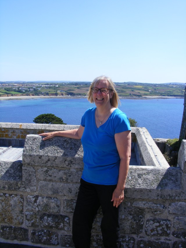
I always encourage my family history students to investigate the working lives of their ancestors and Levant Mine is a ‘must see’ for those with mining ancestors. My own Cornish ancestors worked on the land, rather than under it but it was fascinating nonetheless. Today was a great opportunity to learn more about Cornwall’s industrial heritage.

We arrived at the mine just in time for a guided tour by the indefatigable Richard and boy did he know his stuff. If you plan on visiting the mines, do try to coincide with a guided tour. Tours like this enhance a visit, as there is only so much you can learn from guide books and interpretation boards. Richard talked to us about the mine’s history, without the aid of notes, for two hours. No one dropped out of the tour, not even the two year old or the dog. We gained a real insight into the working lives of the miners. Any errors in what follows are mine and not Richard’s.

There are 1000 mine shafts and hundreds of miles of tunnels on the ‘tin coast’ in the far south-west of Cornwall and commercial mining, notably of copper and tin, has been going on here for 2000 years. There are several Zawns (wave-cut clefts) in close proximity and these might have revealed surface ore that encouraged the early miners. Written records of mining in this area date back to 300BC. The first documentary evidence of speculative mining at Levant is a map of 1748. This mining was by tunnel, rather than shaft and the tunnels were upward sloping, to allow water to drain out and also so gravity would aid the carts loaded with ore. The ore was then taken up to the dressing floor by horse whim. In the eighteenth and early nineteenth centuries there were several small-scale copper mining ventures in the area but in 1820, twenty investors got together to fund the sinking of the first shaft. Their collective initial investment was £400. The shaft was quickly profitable and further shafts were sunk. As they went deeper, water became a problem and a series of increasingly large, steam-powered pumps were purchased over the ensuing years. By 1836 they were not only pumping water but also raising ore by engine.

In 1840 they purchased a beam engine from Harvey’s, the famous foundry in nearby Hayle. This engine remains in situ and running; the oldest engine to be in working order and still at its original site. In the early 1850s a depression resulted in the mass emigration of Cornish miners to hard-rock mining areas throughout the world. They took Cornish customs and the iconic Cornish mine architecture with them to places such as Mexico, South Africa and Moonta in South Australia.

There was some economic recovery in the late 1850s and in 1857, a man engine was installed. This was a hugely significant innovation as no longer did men have to climb 1200 feet of ladders at the beginning and end of the shift. With the engine, they descended in 12 foot increments, in time with the engine’s piston. In this way they made the descent in 130 stages and it took 26 minutes. The structure also allowed the out-going shift to come to the surface and the in-coming shift to descend simultaneously. Previously, there was only space for a single ladder, so it was not possible for miners to be going up and down at the same time.

The mine closed briefly in 1870 as removing water and digging through granite to follow the lodes was becoming prohibitively expensive but new investors were found and it re-opened. This decade saw an increasing use of steam engines and by 1880, pneumatic rock drills were use. These were huge and required several operators. They also created a great deal of dust, that led to lung complaints amongst the miners. Pit ponies were also used. They spent eighteen months continually underground before being retired to the surface, rehabilitated and sold.

In 1919 the man engine collapsed and thirty one miners were killed. This was followed by the bottom dropping out of the tin market. Treasury loans were taken out but they could not repay them and the mine closed in 1930. The workings were in use in the 1960s, as an extension of nearby Geevor mine but this too closed in 1990 and the shafts were allowed to flood.

Conditions underground were harsh, with 30 degree temperatures and debilitating levels of humidity. Add to this the smoke from the tallow candles, which were the only form of lighting and the dust and it is no wonder that the health of the miners was compromised and life expectancy was about forty. Surface work was undertaken by the bal maidens who worked the rock to extract the pure ore. Ragging, spalling, cobbing and bucking gradually reduced the rock in size and finally it was buddled to leave crushed ore. This had to be graded, or jigged, using a pumping action to force water through the ore. Copper smelting took place in Swansea, to save the cost of importing the coal. Tin however was governed by the ancient stannary laws and had to be smelted in Cornwall, so was taken to Penzance.

024 6 July 2019 Levant Mine

The noise of the mechanical tin stamps must have been overpowering. After the tin was buddle, a calciner was used to drive off the impurities, largely arsenic and sulphur. The smoke from the calciners would drift over local villages with resulting ill-effects on health. It was discovered that arsenic was a useful ingredient in insecticides that were used to combat the cotton bol-weevil. This meant that the arsenic was now a valuable by-product. There was an awareness that arsenic could be absorbed through the skin so exposed areas were coated with a thick, white clay paste to combat this. Working with arsenic also caused infertility and allegedly, men volunteered to work with arsenic as a method of family planning.

Richard is going to take us down a tunnel. This is slightly scary but we are up for (almost) anything. It is suggested that we remove our sunglasses as visibility is poor. I have recently acquired glasses that are also sunglasses for the first time. I am proudly wearing them. Great, so now I have the choice between not being able to see because I am wearing sunglasses and not being able to see because I have taken them off. I go for keeping them on. We wander down the tunnel and it certainly is quite dark. Then Richard realises that the lights aren’t working, so all we have is the emergency lighting. He fiddles with the fuse box a bit. We have already walked down the tunnel. I am wondering how we will get back if all his fiddling somehow extinguishes the emergency lighting as well. Never fear, a few messages on his radio and full lighting is restored. The trip ends with a visit to the engine room where we can see the 1840 engine in action, aided by Ron and Tim. Despite all this engagement with mining heritage, there is no sign of Aiden Turner.

I had originally planned to move on to Hayle but decided to go to Trengwaniton Gardens instead. We find this with no trouble but I had failed to check that the opening times would allow for this rearranged itinerary. They don’t. We may or may not return tomorrow. So it is back to the van for more relaxing, more fish and chips (fortunately for the ‘diet’ they only visit twice a week) and some Wimbledon on TV.

For more information about historic Cornish mining see here. If, like me, you are interested in the history of medicine and the ill-health of our ancestors, next month sees another opportunity to take part in my five week online course, ‘In Sickness and in Death: researching the ill-health and death of your ancestors’; there are still a few spaces.

A Day of Culture

An ancient monument to start the day. No not myself or my travelling companion but Chysauster village, which was inhabited for about two hundred years, two thousand years ago. This was just in case we hadn’t already had enough of steep slopes and uneven paths, as the village is in a prominent hill-top location. The climb is made worthwhile by the impressive views and as the glorious weather continues, we can almost see from coast to coast. I have been here before but I am not sure we actually got to the village then. I know we found the fogou as there is photographic evidence but that may have been it. In those days it was an unattended free site, with no interpretation boards beyond a metal sign saying ‘fogou’ and no arrows to the village above. What is a fogou? I hear you ask. You did ask didn’t you? If only I, or indeed anyone else, knew. It is an underground passageway of unknown function, possibly for storage or, alternatively, it may have had a ritual function.

019 5 July 2019 fogou Chysauster

A Fogou

Chysauster itself is a group of stone houses, which were home to 50-70 people, who were perhaps involved in the tin trade. It reminds us of the time we spent in the Neolithic era. One of the roofless houses was used by itinerant Methodist preachers in the nineteenth century. The congregation must have been pretty dedicated to slog all the way up here, as there are not many settlements in the vicinity.

018 5 July 2019 view from Chysauster

We drive down into Penzance and secure the last parking space in Penlee Park. We are here to listen to my friend Liz Shakespeare talk about her book The Postman Poet. This is not just any book as it features my kitchen in a cameo role. We share a pleasant lunch in the sunny park afterwards, then relax (that word again) in the park to wait for evening. Had it been less cozy, we might have walked down to the centre of Penzance but we decide against this. The evening treat is an open-air concert by Fisherman’s Friends. Open-air and England can be a dodgy combination but we could not have had better weather for it. Being somewhat of a chilly mortal, I have come armed with socks, trousers and fleeces but I am able to survive without any of these extra layers, as we listen to shanties and other songs of the sea.

St Michael’s Mount

The fixing the water pump thing requires us to make a trip to a nearby electrical accessories store, which we do. Paying the water pump-fixing man means we also need to find a cash point and we manage that too. Then it is back to Marazion in time for the causeway to St Michael’s Mount to become passable on foot. St Michael’s Mount is one of the most visited tourist attractions in the country and it seems that most people have chosen today. It is quite a slog up the steps to the castle, folk making the ascent are getting a tad warm. We are then squished into small rooms in the castle in close proximity with said fellow visitors, hmm. Eau de sweaty humanity is not pleasant.

010 4 July 2019 from St Michael's Mount-2

St Michael’s Mount is iconic and its similarity to France’s Mont St Michel is not a coincidence, as monks from Normandy, settled on the Cornish version, building a priory here in the twelfth century. The steep rocky island is just off-shore from Marazion and is cut off by the tide for half the day. A Medieval Castle dominates the island, which, after the Dissolution of the Monasteries, passed into the hands of the Crown. It was briefly owned by Elizabeth I’s favourite Robert Cecil and then by the Bassets, who strengthened its defences when fighting for the Royalist cause during the English Civil War. When the garrison surrendered to the Parliamentarian forces, the St Aubyns took up residence and became the owners in 1659. Almost every generation was John St Aubyn but although they shared a name, the temperaments of the various Sir John’s varied from one who was hailed as ‘the least corruptible Member of Parliament’ and another who fathered seventeen children on three women, none of whom were, at the time, his wife. In the nineteenth century the St Aubyns took the title Lord St Levan and they still inhabit the island today.

We hear the story of the eighteenth century clock, which shows the state of the tides as well as the time. A Medieval skeleton of a man, seven feet in height, was found buried in the chapel. The remains were re-interred in the churchyard. There are several ‘giants’ legends associated with the island. If ascending the steep, uneven stone steps and cobbled paths was hard work, the descent was more difficult, not helped by wearing varifocals but I reach the bottom relatively unscathed.

012 4 July 2019 At St Michael's Mount

On previous visits to the mount, I seem to have missed touring the gardens. These are a huge challenge for the gardeners, who have to adapt to steep slopes, very little soil and salt-laden winds. They have nonetheless done a great job. My legs have barely recovered from walking steep Devon streets and ‘racing’ for life so up and down the rocky paths in the heat of the day was somewhat strenuous but worth the effort. We then return to the van to take part in that rare activity ‘relaxation’, whatever that is. Felt obliged to sample the wares of the site’s mobile fish and chip van.


Heading Westward

So, having spent some time in the most north-easterly county of England, we headed instead for the most south-westerly. Both are in my top three English counties. It seemed everyone else had the same idea and traffic was heavy in western Cornwall. I realised that I had inadvertently booked a site with only ‘hot-spot’ internet. Last time we were lucky enough to pitch on one of only three spaces where there was signal. Will we be as lucky again? If not I am going to spend much of my time balancing on one leg in a field trying to log on, as the job we must not mention requires wi-fi and is not yet over.

On arrival, we chose a pleasant, shady pitch (which had wi-fi – yay!) and sited the caravan, skilfully lining up with the marker peg as required. Pleasant and shady it may have been, flat it was not, even our super-dooper, self-levelling legs (that’s the caravan’s legs not our own) couldn’t cope with the incline. It was clear from the marks on the grass that a previous resident of this pitch had parked considerably to the left of the marker, so we did the same. The legs could cope with this so the van was no longer reminiscent of the Crooked House (Blackgang Chine aficionados will understand what I mean). In order to comply with the ‘park with the back corner to the peg’ regulation we judiciously moved the peg.

The next issue was the water pump, or lack of the same. There are two operative words here – ‘water’ – yes, ‘pump’ – no. The helpful warden took a look. We dismantled bits of the van. We summoned a mobile caravan water pump fixing person. Hurrah! We had running water once again – probably just as well as the temperatures are soaring.

In between all the pump fixing we drove a couple of miles to Marazion. We passed a horse rider who commented that the road was melting. She was not wrong, as there were clear impressions of horseshoes on the tarmac. We wandered through Marazion’s narrow street in beautiful sunshine. Mount’s Bay was looking glorious. Marazion’s name was once thought to originate from ‘Market Jew’ and there is a Market Jew Street in the town. It is now thought that the name comes from ‘Marghas Yow’ or Thursday Market. Until Medieval times, when Penzance became dominant, Marazion was the principal town in the area. It is an ancient settlement, whose economic activity was centred on tin smelting. It is held out to be one of the oldest charter towns in England, having been granted a charter by Henry III in 1257. It is forty years since my first visit to Mount’s Bay, when I stayed in a Penzance guest house. The abiding memory of that trip is the whitebait that was served for breakfast each day; I have not eaten whitebait since.

001 3 July 2019 St Michael's Mount