Chris has managed to get his phone to tell him that it is currently 7 degrees (whatever happened to phones that made telephone calls?). What his phone doesn’t tell him is that there is also a wind chill factor of quite a lot. I packed thermals to go to Canada and arrived in temperatures of 27 degrees; here the reverse seems to be true. Undaunted – well maybe just a little daunted – we go forth and search ancestral areas. A quick trip to Chapel of Garioch first. It has to be a quick trip, it is very small. I photograph the cross slab known as the Maiden Stone, one of many Pictish relics in the area. Then it is on to Old Rayne, a few cottages larger than Chapel of Garioch and with a church that is over two miles away from the settlement. As we get out to explore the graveyard we understand the attraction of Penge (south London) where my children’s ancestor from this area ended up. It is truly freezing, although I have to own that Penge probably lacks the scenic value of Rayne.
As the temperature has encouraged us to be pretty swift with our churchyard excursions, we are now much too early to go to the museum at Insch, so we return to the van to thaw out. Sustained and warmed we head back to Insch just as the volunteer is opening up. The museum is only open one afternoon a week so I was glad that I could arrange the itinerary to coincide. I was a bit worried that this museum might be another homage to Pictish culture, very interesting but not what I was after. We wait patiently whilst an Australian, who now lives on the English south coast, tells the complete story of his family history to the volunteer, who makes all the right noises. We have already exhausted the potential of the displays in this very small museum, which is part of the still functioning railway station. Fortunately, it is more nineteenth century than ninth century, with, understandably, a preponderance of railway history. The railway linking Inverness and Aberdeen came through Insch in 1854 and had an enormous impact on the small village. Our fellow enquirer has come by train and needs to get the 2.19pm back again. I know we are in the station but given that the next train isn’t for two hours, I would have been on the platform sooner than 2.18 and thirty seconds. Well, I would have been there from about 2.00pm just in case but I am sure there is a happy medium.
His departure gives us a chance to ask the volunteer, without holding out much hope, if she has heard of Wight’s Inn. She chats away about how old Mrs Wight came down from up country to run the pub. She is past the first flush of youth but she is implying that she remembers Mrs Wight and my Mrs Wight died in 1862 so my heart is sinking. But no, it turns out that she really is talking about my Mrs Wight. The bad news is that Wight’s Inn and the neighbouring Pauper Lodging House run by Mrs Wight’s daughter in law (also Mrs Wight of course but I am attempting not to confuse) have been demolished. Mrs Helpful Volunteer finds a picture and map of the rough location that I can copy. I say we had failed to find a gravestone yesterday and add that I wasn’t really expecting there to have been a marker. Au contraire, our kind assistant is sure there would have been one as she would have been ‘quite wealthy’. She pulls out a list of memorial inscriptions for the old kirk where we were yesterday. This has been compiled by someone we have met through the family history world, so thank you Sheila, we couldn’t have managed without you. Yes, there is Mary Wight, husband James and other members of the family on stone 193. ‘Oh’, she says ominously, ‘it is flat’. We have seen these flat stones, they are buried under an impenetrable layer of strimmed grass. We take note of the rough position and the names of those on the surrounding stones that are still standing, thank our helper and take our leave.
I apologise if something of a theme is developing here but I must again mention toilets. We use the ones in the station. I fail to find the light switch and am in total darkness. I manage to locate the toilet itself but toilet paper proved more of an initiative test. If you are ever in Insch station, on top of the cistern, though I advise trying for the light switch in preference.
 After about five minutes casting our eyes round stones with all the wrong names on and on the point of giving up. I locate Mr Sharp who should be next door to the Wight family. Yes, there is a flat stone nearby but compacted grass, the product of many mowings, is stuck firmly to its surface. I wish, too late, that I had taken a ‘before’ photograph. We begin rubbing away, being careful not to obliterate the sandstone surface at the same time. Grass has grown quite a long way over the edges of the stone, covering the inscription. I decide that we need a spade to remove this. We do not have a spade, how short sighted of us. Chris has his barber surgery kit in the boot ready for a conference at the end of our trip. I suggest using one of his many knives, saws or axes to hack back the grass; he seems less keen. We imperil our finger nails by hauling at the grass roots. As for the mowing detritus, in the end we perfect a technique of rubbing the soles of our shoes over the grass, which eventually loosens and can be swept away. This works better with my trainers as Chris has smooth soled shoes on. Well, that was his theory and he was sticking to it. It is quite a large stone and I am rubbing vigorously. If you are ever tempted to try this, be warned, it involves a lot more effort than you would think. The weather has meant that today is the first day we haven’t been for a walk but I decide that stone clearing constituted sufficient exercise. Ten minutes later and the stone is as clear as it is ever going to be and I am well pleased.
We go to the former site of Wight’s Inn, very close to the leisure centre we visited yesterday. We have a much better impression of the lives of this family now. The railway predated Mary Wight junior’s move south by more than two decades and was presumably her route to the outside world. Mary Wight, her grandmother, sounds quite a character, widowed at sixty, taking over the pub and living to be over ninety. The only disappointment is that the building no longer stands. Back to the van then to write up what I have found.
 for 12.15, along with many rabbits. This is my first internet access for four days and even this is only courtesy of Chris’ phone. Three hundred emails arrive on my computer, deep joy. Nothing features on our to do list for this afternoon. Our map indicates that there is a National Trust for Scotland property nearby so we head off to Leith Hall. Leith Hall itself, it turns out, is shut however we can follow the Kirkhill trail rounds the grounds and look at the gardens, which we do. A collapsed bridge means that the pond trail is impassable but we see a Dule Tree. This we learn is a large sycamore, allegedly used as a gallows. Dule is from the Gaelic for grief and sycamores on mounds may have been used as sites of mourning. Today is overcast and the wind is chilly but we complete our walk without getting rained on.
 ng that they might see bears at ‘Highland Bear Lodge’. Maybe highland bears are akin to yellow tits and indeed the Loch Ness monster. We drive through pretty birch woods to Glen Affric. There are more sheep in the road; these are sitting down contentedly as if they were in a field. There are deer relaxing nearby, maybe they have evicted the sheep. We pass the Fasnabyle HEP plant, reminding us how important the energy business is to Scotland. We head back towards Inverness by a different route, with the River Glass on the right and a bluebell wood on the left to enter the Black Isle, between the Moray Forth and Cromarty Firth. This peninsula, previously named Ardmeanach, was given to Lord Darnley by Mary Queen of Scots. The views are glorious. I find this one of the most attractive parts of Scotland, yet I was expecting to prefer the west coast.
 It is interesting to fully appreciate that Cumberland’s government red-coat army of 10,000 men would need 10,000lb meat and 10,000lb bread each day to sustain them. The lack of supplies for the Jacobite forces was a significant feature at Culloden, along with the boggy terrain which led to the failure of their previously successful charging technique. The battle lasted less than an hour and nearly half the 1500 Jacobite casualties fell in the few minutes of this failed charge. The government troops lost only 50 men, although some of the 250 wounded died later. The Irish and French, who were fighting for the Jacobites, shielded Bonnie Prince Charlie’s retreating army, who headed for Inverness after the battle. These Irish and French were subsequently treated as prisoners of war not rebels. The Jacobites did regroup at Ruthven and were prepared to fight on but Bonnie Prince Charlie sent orders to disperse and the cause was lost, leaving Charlie to escape ‘over the sea to Skye’ with the aid of Flora MacDonald.
 Our first stop is the capital, Kirkwall. I am very excited to learn that St Magnus’ Cathedral is currently the site of the first Scottish exhibition of the ceramic poppies, that I narrowly missed at the Tower of London. The weeping wall of poppies is here to commemorate the 100th anniversary of the Battle of Jutland on 31 May. Aptly, two doves have nested in the poppies. The red sandstone cathedral was founded by Rognvald, nephew of Magnus Erlendsson in 1137. Magnus, Earl of Orkney, had been killed on the orders of his cousin and fellow earl, Hakon. In 1468 James III gave the cathedral to the people of Kirkwall. Post reformation the cathedral was used for Protestant worship and can now be used by any denomination. We also see the nearby Bishop’s and Earl’s palaces.
 I have been really looking forward to visiting the Neolithic village at Skara Brae, especially after our own foray into the Neolithic era. The stone dwellings here are very different from our constructions at Old Sarum – different landscape, different building material available. The settlement is 5000 years old, older than the Pyramids, Stonehenge, the Parthenon and the Great Wall of China. It was hidden for centuries and rediscovered after a fierce storm in 1850. The life expectancy of those who lived here from c3100-2500 BC was thought to have been about 20. The trouble with this kind of trip is that three coach loads of tourists are deposited at attractions at the same time making photography difficult but we do our best. At least our party are prompt at returning to the coach at the designated time, perhaps persuaded by the rain.
 Our site at Dunnet Bay is exposed but right by the sea and we have a pitch that has what might be classed as ‘sea glimpses’. After setting up the van we depart for John O’Groats, well you have to don’t you? It isn’t quite as commercialised as Land’s End or Gretna Green and it seemed important to visit what claims to be the most north-easterly settlement in Britain. There are some weird multi-coloured wooden buildings, which are apparently extensions to a hotel. If they were trying to look like Balamorey they’ve failed. A little like Land’s End it isn’t actually the extremity that people would have you believe. Dunnet Head is the most northerly point and we plan to visit there before we leave. We are primarily in John O’Groats to pick up our tickets for tomorrow’s trip to Orkney and to see where we need to be first thing in the morning. That accomplished, we move on to Duncansby Head. We arrive in a fierce hail storm and decide to sit it out, hoping for a gap in the precipitation so we can visit the fulmar colonies that nest on the cliffs here. Yes, Scotland’s weather does it again and within ten minutes it is dry and we decide to risk it. The ground however is anything but dry and is best described as spongy. Chris has his walking boots; mine are in the van so I paddle along in trainers as far as Duncansby Stacks.
 Anyway not boats, gardens or ticks but an RSPB reserve. I don’t get much opportunity to utilise my RSPB life membership so I am not going to miss this one. Like Loch of Lowes there are nest cams on an Ospreys’ nest that has been in the same location for decades. The female, EJ, unimaginatively named for the letters on her leg ring, has been using it since 2003 and has gone through three partners in that time, producing twenty five chicks. The current male is Odin and both adults are on the nest most of the time we are there. This year’s brood have hatched, one five days ago and one at 4.30am this morning. The egg laying and therefore the hatching, is staggered to give at least one chick a chance of survival. Today’s chick still has its head in the egg shell. The staff continually monitor the nest to guard against vandals, poachers and egg collectors. There is great excitement as a third osprey flys overhead and Odin’s alarm calls are clearly heard. This reserve gets full marks for its nest cam, as the screen allows you to take clear photographs, although the nest itself is too far away for my camera. Their viewing window is in rather a dark corner, so my attempts at photographing siskins and greenfinches through glass are less successful than those through the viewing window at Loch of the Lowes.
 As we have come quite a distance to spend not very long looking at the barracks we decide to stop off at Loch an Eilean on the Rothiemurchus Estate on the way back. The original plan was to walk four miles or so round the loch. By this time it is not only 5.00pm but very cold and drizzling so, despite having made a financial investment for car parking, we just take a very short walk along the loch side to see the castle in the middle of loch. We try and fail to find the monument to Major General Brook Rice who drowned in the loch whilst skating. This is allegedly the number one picnic place in the UK. I debate whether this is a self-styled title. I am sure it would be very lovely if the temperature were fifteen degrees higher. Having satisfied ourselves that we have actually done something today, we head for home. The weather forecast for our booked trip on the funicular railway tomorrow is not encouraging, ah well, this is Scotland and rain it must.
 This year more than makes up for the disappointments of our previous visit. The adult ospreys arrived in March from their winter home; they spend the season in places such as Senegal and Gambia. They are taking it in turns to sit on three eggs and ‘nest cam’ provides a great view. The eggs are due to hatch tomorrow. I take a rather grainy photograph of the nest cam screen and one on full zoom (which on my camera isn’t very full) of the nest itself from the hide. I am almost as excited to see reed buntings as I am the ospreys.
 We return to the viewing window where a gala performance is in progress. Two red squirrels who stay around long enough for a photo call and numerous birds including yellowhammers and a greater spotted woodpecker. I get some photographs that, considering I have a pretty basic camera and am taking them through glass from a fair distance, come out quite well; some are even in focus. I was somewhat disconcerted to overhear one of the volunteers telling a group of secondary school pupils that they were looking at a ‘yellow tit’ but maybe she was taking the proverbial. Note to overseas readers – there are no yellow tits – blue tits are predominantly yellow (confusing I know) but definitely no such thing as a yellow tit.
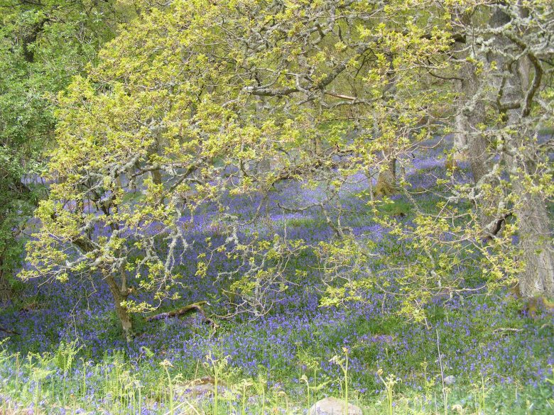 We walk for a mile or so along Fungarth Path towards Dunkeld. The ‘fun’ is provided by ‘talking posts’, which play recorded information when you press a foot pedal. The instruction is to ‘keep pumping’, so I pump continuously and rapidly for a few minutes before realising that I have heard the same thing three times. It is jolly hard work all this vigorous pumping so I am please to work out, by post three, that it is, in fact, possible to pump half a dozen times and then stop, whilst the voice keeps going.
 It is a lovely sunny day, contrary to the predictions of weather forecasters, although there is still snow on the nearby peaks. We take a walk a mile or so into Killin and follow some of the heritage trail. Here we are in what is described as ‘The Heart of Breadalbane’, or the high country of ‘Alba’, which was an ancient Scottish kingdom. Killin is a natural place for a settlement as it is at the confluence of the Dochart and the Lochay rivers. Our walk takes us as far as Dochart Falls, which are beautiful.